Flag of Guatemala

Guatemalan Gringo Trail

Blog · Route

Pick your direction
ShuttleFlight

Twelve days through Guatemala, either way round. Volcanoes, a lake with a dozen villages on its shore, a river under a limestone bridge and a Maya city in the jungle, with what each cost in quetzales. Pick up quetzales at your bank before you leave. ATM fees add up fast, and outside hotels and city restaurants, Guatemala runs on cash. Roughly Q7.6 to US$1.

Guatemala 12 days 6 stops
Land in Guatemala City
Fly into La Aurora (GUA), then take a shuttle straight to Antigua.
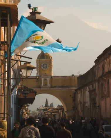
The Santa Catalina Arch in Antigua, with Volcán Agua behind it
2 Days 1–3
Sacatepéquez

Antigua

Getting there Uber or shuttle · 1h

A small colonial city and UNESCO heritage site an hour west of Guatemala City, surrounded by three volcanoes: Agua, Acatenango and Fuego. It sits at 1,530 m. Cobblestone streets, low pastel houses and ruined churches. Compact enough to cross on foot in twenty minutes, and the base most travellers use for the volcano hikes.

What we did
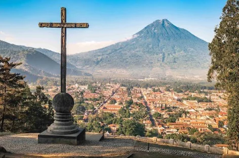
The cross at Cerro de la Cruz overlooking Antigua and Volcán Agua
Cerro de la Cruz at sunrise
15 minutes hike from the centre of town, perfect view of Volcán Agua
Free
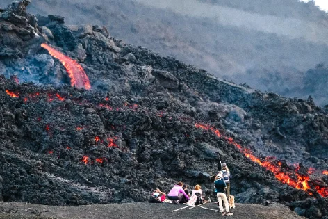
Hikers watching lava flow down the slope of Pacaya volcano
Pacaya volcano hike
half day volcano hike, you can roast marshmallows or cook pizza in the lava vents
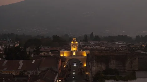
The Santa Catalina Arch lit up at night, seen from a rooftop
Rooftop at Iglesia de la Merced
Stunning sunset views from the top of the church
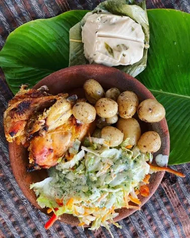
A plate of roasted chicken, potatoes, coleslaw and a tamale
Rinconcito Antigüeño
Local favourite chicken restaurant.
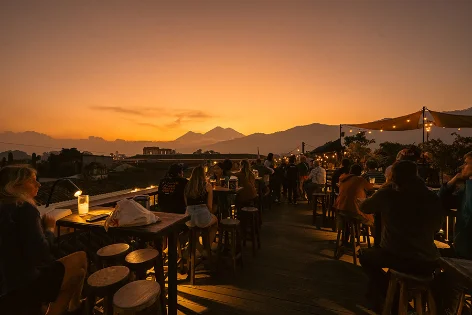
Rooftop drinks at sunset with a volcano silhouette in the distance
Rooftop drinks at Antigua Brewery
Try some locally brewed beer while overlooking the city
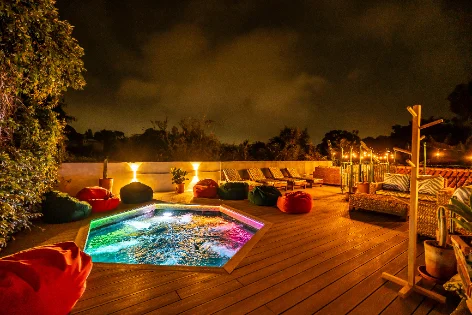
A lit-up plunge pool on the rooftop deck at Lura Hostel
Stay at Lura Hostel
Best mix of comfort/cost a block away from the center of town
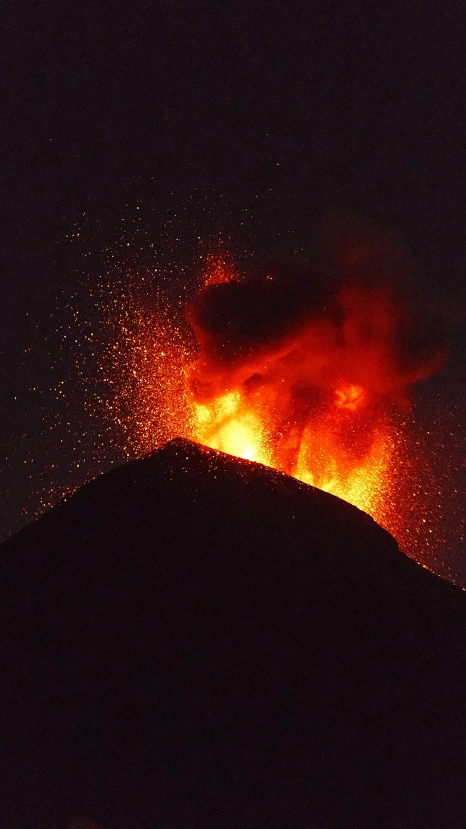
Volcán Fuego erupting at night, seen from Antigua
Challenging add-on +2 days

Volcán Acatenango and Fuego

Two days, 3,976 m, camp facing Fuego erupting all night. The hardest and best thing on this list. Slot it in after Antigua if your legs and lungs are up for it. Talk to your doctor about altitude medication before you book.
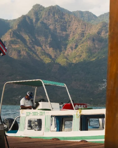
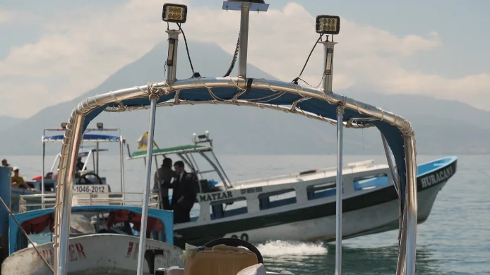
A tour boat on Lake Atitlán, framed by the surrounding volcanoes
3 Days 4–6
Sololá

Lake Atitlán

Getting there Shuttle · 3h

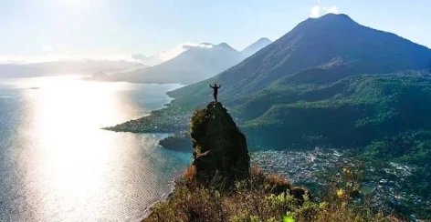
A crater lake in the western highlands at 1,560 m, roughly 340 m deep and framed by the San Pedro, Tolimán and Atitlán volcanoes. Around a dozen towns sit on the shoreline, most reachable only by public lancha: Panajachel is the transport hub, San Marcos is the quiet end, San Juan is known for weaving co-ops, and San Pedro for its nightlife. Kaqchikel and Tz’utujil Maya communities make up most of the population.

What we did
Lanchas docked on Lake Atitlán with a volcano behind them
Town hop on the lake
Panajachel → San Marcos → San Juan → San Pedro. Pay on board.
A hiker on the Indian Nose overlook above Lake Atitlán at sunrise
Indian Nose sunrise hike
Leave San Juan at 4am; guide included. The lake turns pink.
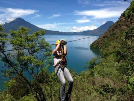
Zip-lining over the forest at Reserva Natural Atitlán
Reserva Natural Atitlán
Hanging bridges, waterfalls and a butterfly dome, twenty minutes from Panajachel.
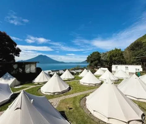
Glamping tents on the lawn at Free Cerveza Hostel, lake behind
Stay at Free Cerveza Hostel
Tent camp on the lakeshore near San Marcos, with a free beer hour every evening.
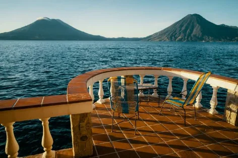
The lake-view terrace at Casa del Mundo, volcanoes on both sides
Lunch at Casa del Mundo
Cliffside hotel in Jaibalito, reached by lancha. Lunch on the terrace, right over the water.
A group celebrating on a boat during a San Pedro boat party
San Pedro boat party
An afternoon on a lancha with music and drinks, run out of the San Pedro hostels.
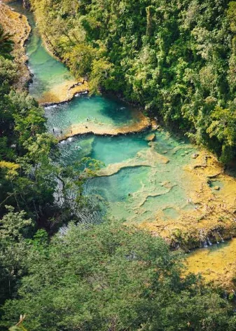
Aerial view of the turquoise stepped pools at Semuc Champey
4 Days 7–8
Alta Verapaz · via Lanquín

Semuc Champey

Getting there Shuttle · 8–9h

A natural monument in Alta Verapaz: a 300 m limestone bridge over the Río Cahabón, with a staircase of turquoise pools on top of it. The nearest town is Lanquín, 10 km away on unpaved road, and the region is humid jungle at around 300 m. Getting there is the hard part: eight to nine hours by shuttle from Antigua or the lake.

What we did
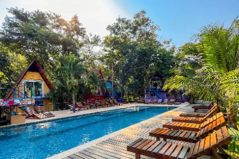
The pool at Greengos Hostel, ringed by cabins and palms
Stay at Greengos Hostel
Where we stayed in Semuc: easy base for the pools and cave.
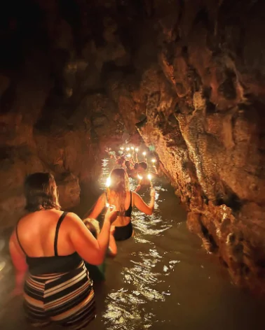
Wading through the K’anba candle cave by candlelight
K'anba candle cave
Wading and swimming through a river cave by candlelight. Not for the claustrophobic.
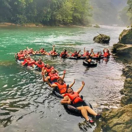
A group tubing down the Río Cahabón in life jackets
Tubing the Río Cahabón
Forty lazy minutes downriver back to the hostel.
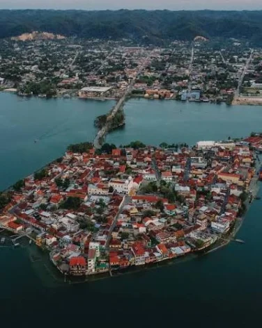
Aerial view of Flores, the island town on Lake Petén Itzá
5 Day 9
Petén

Flores

Getting there Shuttle · 8h

A small island town on Lake Petén Itzá in the northern lowlands, joined to the mainland by a causeway to Santa Elena. Hot and flat, with a single ring of streets you can walk in fifteen minutes. The nearest airport is Mundo Maya (FRS) in Santa Elena, and Flores is the standard base for visiting Tikal, 65 km north.

What we did
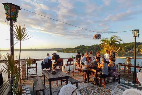
Sunset drinks on the deck at Sky Bar, overlooking Lake Petén Itzá
Cocktails at Sky Bar
Rooftop on the island. Go for sunset over Lake Petén Itzá.
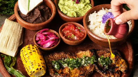
A Mayacuya brunch platter: grilled fish, corn, tamale and salsas
Brunch at Mayacuya
Café on the island for a slow breakfast the morning after Tikal.
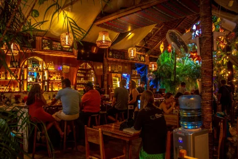
The lantern-lit bar at Los Amigos Hostel in Flores
Stay at Los Amigos Hostel
Social hostel in a jungle garden in the middle of the island.
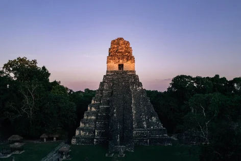
Temple II rising above the jungle canopy at Tikal at dusk
6 Day 10
Petén

Tikal

Getting there Shuttle · 1.5h

A Maya city in the Petén rainforest, occupied from roughly 600 BC to 900 AD and one of the largest in the Maya world. Six steep temple-pyramids rise above the canopy, Temple IV being the tallest at 70 m. The site is a national park and a UNESCO World Heritage listing; paths between the plazas run for kilometres through jungle, and wildlife is easy to see early in the day.

What we did
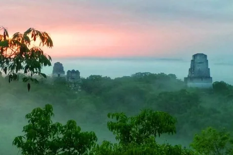
Temple tops breaking through the morning mist at Tikal
Tikal sunrise tour
Park entry, sunrise permit and guide. Up at 3am, worth every minute of it.
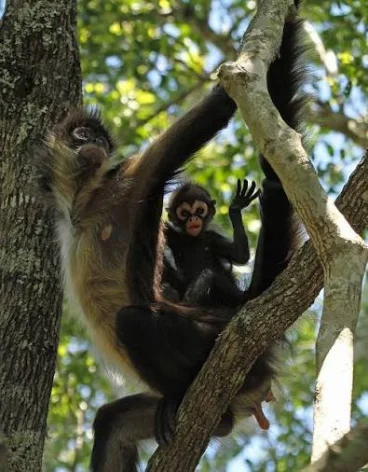
A spider monkey and its baby in the canopy at Tikal
Spot the wildlife
Coatis on the paths, howler and spider monkeys in the canopy. Keep looking up.
Free
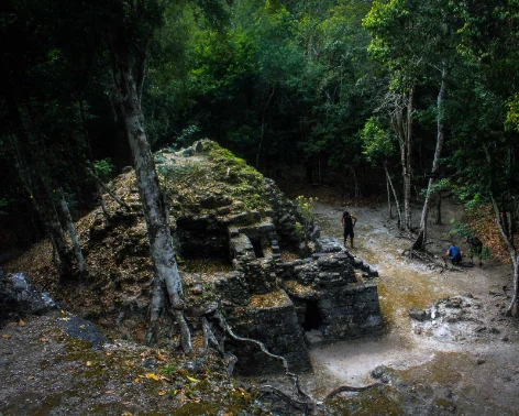
A jungle-covered temple mound on the trek to El Mirador
Challenging add-on +6 days
El Mirador trek
The hard add-on: six days on foot through the jungle to La Danta, the largest pyramid in the world by volume. Mules, camps, no roads.
Land in Guatemala City
Fly into La Aurora (GUA), then straight onto a connecting flight to Flores. No need to stay the night.
Aerial view of Flores, the island town on Lake Petén Itzá
2 Day 1
Petén

Flores

Getting there Fly GUA → FRS · 1h

A small island town on Lake Petén Itzá in the northern lowlands, joined to the mainland by a causeway to Santa Elena. Hot and flat, with a single ring of streets you can walk in fifteen minutes. The nearest airport is Mundo Maya (FRS) in Santa Elena, and Flores is the standard base for visiting Tikal, 65 km north.

What we did
Sunset drinks on the deck at Sky Bar, overlooking Lake Petén Itzá
Cocktails at Sky Bar
Rooftop on the island. Go for sunset over Lake Petén Itzá.
A Mayacuya brunch platter: grilled fish, corn, tamale and salsas
Brunch at Mayacuya
Café on the island for a slow breakfast the morning after Tikal.
The lantern-lit bar at Los Amigos Hostel in Flores
Stay at Los Amigos Hostel
Social hostel in a jungle garden in the middle of the island.
Temple II rising above the jungle canopy at Tikal at dusk
3 Day 2
Petén

Tikal

Getting there Shuttle · 1.5h

A Maya city in the Petén rainforest, occupied from roughly 600 BC to 900 AD and one of the largest in the Maya world. Six steep temple-pyramids rise above the canopy, Temple IV being the tallest at 70 m. The site is a national park and a UNESCO World Heritage listing; paths between the plazas run for kilometres through jungle, and wildlife is easy to see early in the day.

What we did
Temple tops breaking through the morning mist at Tikal
Tikal sunrise tour
Park entry, sunrise permit and guide. Up at 3am, worth every minute of it.
A spider monkey and its baby in the canopy at Tikal
Spot the wildlife
Coatis on the paths, howler and spider monkeys in the canopy. Keep looking up.
Free
A jungle-covered temple mound on the trek to El Mirador
Challenging add-on +6 days
El Mirador trek
The hard add-on: six days on foot through the jungle to La Danta, the largest pyramid in the world by volume. Mules, camps, no roads.
Aerial view of the turquoise stepped pools at Semuc Champey
4 Days 3–4
Alta Verapaz · via Lanquín

Semuc Champey

Getting there Shuttle via Flores · 9h

A natural monument in Alta Verapaz: a 300 m limestone bridge over the Río Cahabón, with a staircase of turquoise pools on top of it. The nearest town is Lanquín, 10 km away on unpaved road, and the region is humid jungle at around 300 m. Getting there is the hard part: eight to nine hours by shuttle from Antigua or the lake.

What we did
The pool at Greengos Hostel, ringed by cabins and palms
Stay at Greengos Hostel
Where we stayed in Semuc: easy base for the pools and cave.
Wading through the K’anba candle cave by candlelight
K'anba candle cave
Wading and swimming through a river cave by candlelight. Not for the claustrophobic.
A group tubing down the Río Cahabón in life jackets
Tubing the Río Cahabón
Forty lazy minutes downriver back to the hostel.
The Santa Catalina Arch in Antigua, with Volcán Agua behind it
5 Days 5–7
Sacatepéquez

Antigua

Getting there Shuttle · 8h

A small colonial city and UNESCO heritage site an hour west of Guatemala City, surrounded by three volcanoes: Agua, Acatenango and Fuego. It sits at 1,530 m. Cobblestone streets, low pastel houses and ruined churches. Compact enough to cross on foot in twenty minutes, and the base most travellers use for the volcano hikes.

What we did
The cross at Cerro de la Cruz overlooking Antigua and Volcán Agua
Cerro de la Cruz at sunrise
15 minutes hike from the centre of town, perfect view of Volcán Agua
Free
Hikers watching lava flow down the slope of Pacaya volcano
Pacaya volcano hike
half day volcano hike, you can roast marshmallows or cook pizza in the lava vents
The Santa Catalina Arch lit up at night, seen from a rooftop
Rooftop at Iglesia de la Merced
Stunning sunset views from the top of the church
A plate of roasted chicken, potatoes, coleslaw and a tamale
Rinconcito Antigüeño
Local favourite chicken restaurant.
Rooftop drinks at sunset with a volcano silhouette in the distance
Rooftop drinks at Antigua Brewery
Try some locally brewed beer while overlooking the city
A lit-up plunge pool on the rooftop deck at Lura Hostel
Stay at Lura Hostel
Best mix of comfort/cost a block away from the center of town
Volcán Fuego erupting at night, seen from Antigua
Challenging add-on +2 days

Volcán Acatenango and Fuego

Two days, 3,976 m, camp facing Fuego erupting all night. The hardest and best thing on this list. Slot it in after Antigua if your legs and lungs are up for it. Talk to your doctor about altitude medication before you book.
A tour boat on Lake Atitlán, framed by the surrounding volcanoes
6 Days 8–10
Sololá

Lake Atitlán

Getting there Shuttle · 3h

A crater lake in the western highlands at 1,560 m, roughly 340 m deep and framed by the San Pedro, Tolimán and Atitlán volcanoes. Around a dozen towns sit on the shoreline, most reachable only by public lancha: Panajachel is the transport hub, San Marcos is the quiet end, San Juan is known for weaving co-ops, and San Pedro for its nightlife. Kaqchikel and Tz’utujil Maya communities make up most of the population.

What we did
Lanchas docked on Lake Atitlán with a volcano behind them
Town hop on the lake
Panajachel → San Marcos → San Juan → San Pedro. Pay on board.
A hiker on the Indian Nose overlook above Lake Atitlán at sunrise
Indian Nose sunrise hike
Leave San Juan at 4am; guide included. The lake turns pink.
Zip-lining over the forest at Reserva Natural Atitlán
Reserva Natural Atitlán
Hanging bridges, waterfalls and a butterfly dome, twenty minutes from Panajachel.
Glamping tents on the lawn at Free Cerveza Hostel, lake behind
Stay at Free Cerveza Hostel
Tent camp on the lakeshore near San Marcos, with a free beer hour every evening.
The lake-view terrace at Casa del Mundo, volcanoes on both sides
Lunch at Casa del Mundo
Cliffside hotel in Jaibalito, reached by lancha. Lunch on the terrace, right over the water.
A group celebrating on a boat during a San Pedro boat party
San Pedro boat party
An afternoon on a lancha with music and drinks, run out of the San Pedro hostels.
Honorable mention

El Paredón

A black-sand fishing village on the Pacific coast, about two and a half hours by shuttle from Antigua. Consistent beach-break surf, mangrove channels behind the town, and a handful of low-key hostels along a sandy main street.

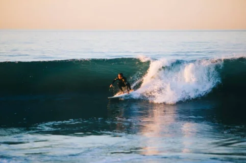
A surfer dropping into a wave at El Paredón
Surf lesson
Black-sand beach break, board and instructor for two hours.
A wooden boat gliding through the mangrove channels at El Paredón
Mangrove sunrise tour
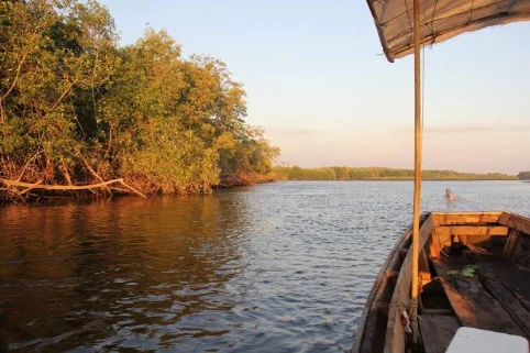
Paddle through the estuary at first light.
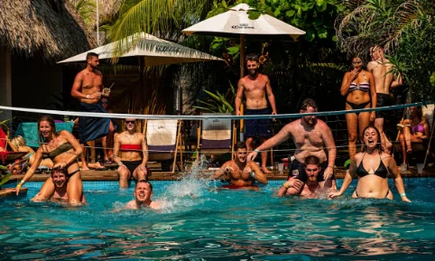
Guests playing pool volleyball at Mellow Hostel
Stay at Mellow Hostel
Low-key hostel a short walk from the beach.

This trip in Mapogo

Map

Flag of Guatemala1new country
5 of 22departments
7+cities
Departments
GuatemalaSacatepéquezSololáAlta VerapazPetén Escuintla, with El Paredón

Trackers

UNESCO sites 2 of 4 in Guatemala
Antigua GuatemalaAntiguaTikal Archaeological Park and Ruins of QuiriguaNational Archaeological Park Tak’alik Ab’aj
Big hikes 1 of 1 in Guatemala
AcatenangoVolcano add-on
Monuments 1 of 2 in Guatemala
Santa Catalina ArchAntigua Torre del Reformador
Harrison Starke